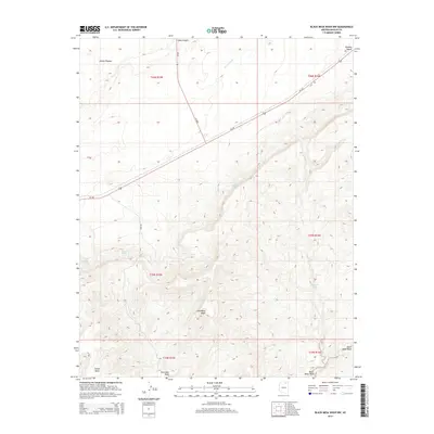
2014 Map of Black Mesa Wash NW
USGS Topo · Published 2014About this map
Shonto Plateau dominates the northern reaches of this Navajo County landscape, where the high desert terrain is carved by the deep drainage of Shato Canyon and the expansive Klethla Valley. The topography here is defined by a series of critical water sources that would have been vital for local habitation and livestock, including Pat Williams Spring, Willow Spring, and the uniquely named Sheepskin Spring. Transport across this portion of the Navajo Nation is centered on the corridor of Us-160, which cuts diagonally across the plateau, while smaller routes like Bia-6620 provide access to the more interior reaches of the mesa. In the south, the land falls away toward the Coal Mine Wash and Black Mesa Wash, revealing a complex network of canyons and ridges near the distinctive Yellow Butte.
Find a feature on this map
20 named features on this map. Tap any name to fly to it.
Don’t see what you’re looking for? This feature index may not catch every label — zoom into the map to look around manually.
Map Details
Editions of this 2014 Black Mesa Wash NW Map
This is the sole edition of this map. No revisions or reprints were ever made.
Other maps of this area

1883 · Marsh Pass
USGS Topo · 1:250,000

1892 · Marsh Pass
USGS Topo · 1:250,000

1956 · Marble Canyon
USGS Topo · 1:250,000

1959 · Marble Canyon
USGS Topo · 1:250,000

1961 · Marble Canyon
USGS Topo · 1:250,000

1970 · Cow Springs
USGS Topo · 1:24,000
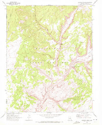
1970 · Kydestea Spring
USGS Topo · 1:24,000

1970 · Black Mesa Wash NW
USGS Topo · 1:24,000

1970 · Whirlwind Rock
USGS Topo · 1:24,000

1970 · Shonto SE
USGS Topo · 1:24,000