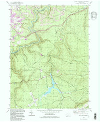
1994 Map of Black Moshannon
USGS Topo · Published 1997About this map
The high plateau of the Allegheny Front dominates this portion of Centre and Clearfield Counties, where conservation lands meet a legacy of heavy industry. Black Moshannon State Park sits at the heart of the landscape, centered on the unique bog-like waters of Black Moshannon Lake. This natural area is tightly bordered by the expansive Moshannon State Forest and State Game Lands No 33, creating a large contiguous wilderness block in the Pennsylvania wilds.
Find a feature on this map
47 named features on this map. Tap any name to fly to it.
Don’t see what you’re looking for? This feature index may not catch every label — zoom into the map to look around manually.
Map Details
Editions of this 1994 Black Moshannon Map
This is the sole edition of this map. No revisions or reprints were ever made.
Other maps of this area

1908 · Bellefonte
USGS Topo · 1:62,500

1909 · Bellefonte
USGS Topo · 1:62,500

1922 · Philipsburg
USGS Topo · 1:62,500

1928 · Snow Shoe
USGS Topo · 1:48,000

1929 · Karthaus
USGS Topo · 1:62,500

1931 · Show Shoe
USGS Topo · 1:62,500

1932 · Karthaus
USGS Topo · 1:62,500

1939 · Philipsburg
USGS Topo · 1:62,500

1943 · Lewistown
USGS Topo · 1:125,000

1945 · Philipsburg
USGS Topo · 1:62,500