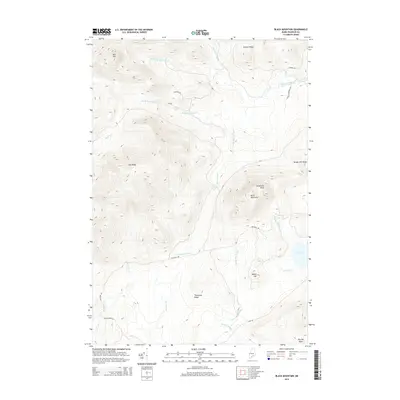
2014 Map of Black Mountain
USGS Topo · Published 2014About this map
Black Mountain and Boil Mtn dominate this Franklin County landscape, where the headwaters of the Alder Stream network carve through high ridges. This 2014 survey documents a region defined by its timber and recreational geography rather than permanent settlements. Transport is limited to a network of unpaved corridors including Tim Pond Rd, Mason Camps Rd, and Loop Rd, which navigate the steep elevations of Threemile Ridge and Cow Ridge. The presence of named water features like Tim Pond, Hack Inlet, and Big Sag Brook suggests a landscape utilized for seasonal camps and backcountry access. Local landmarks like Elephants Head and the descriptively named Toenail Ridge provide orientation in this densely forested terrain within Alder Stream Township.
Find a feature on this map
29 named features on this map. Tap any name to fly to it.
Don’t see what you’re looking for? This feature index may not catch every label — zoom into the map to look around manually.
Map Details
Editions of this 2014 Black Mountain Map
This is the sole edition of this map. No revisions or reprints were ever made.
Other maps of this area

1928 · Chain Lakes
USGS Topo · 1:48,000

1931 · Cupsuptic
USGS Topo · 1:48,000

1932 · Kennebago Lake
USGS Topo · 1:48,000

1932 · Arnold Pond
USGS Topo · 1:48,000

1932 · Chain Lakes
USGS Topo · 1:62,500

1934 · Cupsuptic
USGS Topo · 1:62,500

1935 · Kennebago Lake
USGS Topo · 1:62,500

1935 · Chain Lakes
USGS Topo · 1:62,500

1935 · Cupsuptic
USGS Topo · 1:62,500

1935 · Arnold Pond
USGS Topo · 1:62,500
Featured Places
- Alder Stream Township, ME
- Seven Ponds Township, ME
- Stetsontown Township, ME
- Tim Pond Township, ME
- Franklin County, ME