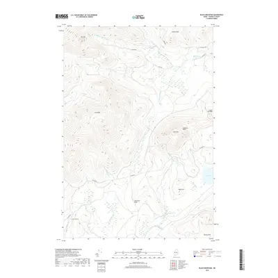
2018 Map of Black Mountain
USGS Topo · Published 2018About this map
Black Mtn and the surrounding high ground of Franklin County, Maine, dominate this remote landscape of the Boundary Mountains region. The complex drainage network of Alder Stream is clearly visible, with its north, south, west, and middle branches converging as they flow through the timberlands. Unlike more developed areas, the human footprint here is limited to a sparse network of logging and access roads such as Tim Pond Rd and N Branch Rd, reflecting the area's long-standing character as a managed forest and recreational wilderness.
Find a feature on this map
31 named features on this map. Tap any name to fly to it.
Don’t see what you’re looking for? This feature index may not catch every label — zoom into the map to look around manually.
Map Details
Editions of this 2018 Black Mountain Map
This is the sole edition of this map. No revisions or reprints were ever made.
Other maps of this area

1928 · Chain Lakes
USGS Topo · 1:48,000

1931 · Cupsuptic
USGS Topo · 1:48,000

1932 · Kennebago Lake
USGS Topo · 1:48,000

1932 · Arnold Pond
USGS Topo · 1:48,000

1932 · Chain Lakes
USGS Topo · 1:62,500

1934 · Cupsuptic
USGS Topo · 1:62,500

1935 · Kennebago Lake
USGS Topo · 1:62,500

1935 · Chain Lakes
USGS Topo · 1:62,500

1935 · Cupsuptic
USGS Topo · 1:62,500

1935 · Arnold Pond
USGS Topo · 1:62,500
Featured Places
- Alder Stream Township, ME
- Seven Ponds Township, ME
- Stetsontown Township, ME
- Tim Pond Township, ME
- Franklin County, ME