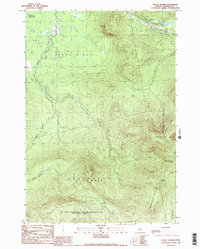
1989 Map of Black Nubble
USGS Topo · Published 1989About this map
The US Navy Survival Escape And Evasion Training Facility occupies a significant portion of this late-20th-century topographic record of Franklin County. This high-altitude landscape is characterized by prominent peaks including Crocker Mountain, South Crocker Mtn, and Mount Redington, alongside the distinctive Black Nubble. The map detail shows the complex hydrology of the region, where the West Branch and Skunk Branch converge into Nash Stream, which flows northward toward the South Br Dead River. The area is sparsely settled, defined largely by township boundaries such as Coplin Plt, Redington, and Wyman. A Scenic Trail winds through the eastern portion, providing a point of interest for recreational history within the Carrabassett Valley.
Find a feature on this map
20 named features on this map. Tap any name to fly to it.
Don’t see what you’re looking for? This feature index may not catch every label — zoom into the map to look around manually.
Map Details
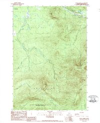
Editions of this 1989 Black Nubble Map
2 editions found
Other maps of this area

1928 · Stratton
USGS Topo · 1:48,000

1929 · Phillips
USGS Topo · 1:48,000

1932 · Phillips
USGS Topo · 1:62,500

1932 · Stratton
USGS Topo · 1:62,500

1932 · Kennebago Lake
USGS Topo · 1:48,000

1933 · Rangeley
USGS Topo · 1:48,000

1935 · Kennebago Lake
USGS Topo · 1:62,500

1936 · Kennebago Lake
USGS Topo · 1:62,500

1939 · Rangeley
USGS Topo · 1:62,500

1949 · Jackman
USGS Topo · 1:250,000
Featured Places
- Carrabassett Valley, ME
- Coplin Plantation, ME
- Wyman Township, ME
- Mount Abram Township, ME
- Redington Township, ME