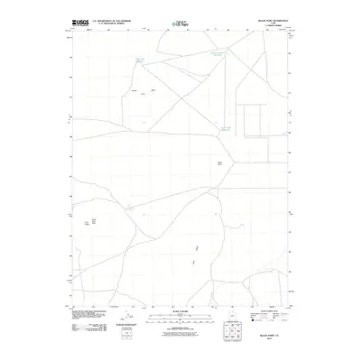
2010 Map of Black Point
USGS Topo · Published 2010About this map
The arid Millard County landscape is dominated by volcanic geography and high-desert water management features in this 2010 study. A prominent geologic feature, Lava Ridge, runs through the southern section of the quadrangle, illustrating the volcanic history of the region. This volcanic presence is further marked by high points such as North Twin Peak and the larger formation of Twin Peaks, while Black Point serves as another distinctive landmark in the central terrain.
Find a feature on this map
9 named features on this map. Tap any name to fly to it.
Don’t see what you’re looking for? This feature index may not catch every label — zoom into the map to look around manually.
Map Details
Editions of this 2010 Black Point Map
This is the sole edition of this map. No revisions or reprints were ever made.
Other maps of this area

1885 · Beaver
USGS Topo · 1:250,000

1953 · Richfield
USGS Topo · 1:250,000

1958 · Richfield
USGS Topo · 1:250,000

1962 · Tabernacle Hill
USGS Topo · 1:62,500

1962 · Cove Fort
USGS Topo · 1:62,500

1973 · Cruz
USGS Topo · 1:24,000

1973 · Antelope Spring
USGS Topo · 1:24,000
1973 · Borden
USGS Topo · 1:24,000

1980 · Richfield
USGS Topo · 1:100,000
1986 · Sixmile Point
USGS Topo · 1:24,000