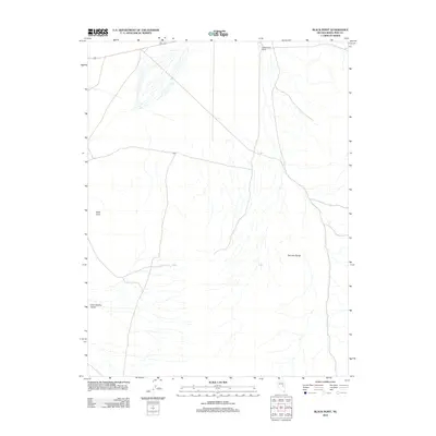
2012 Map of Black Point
USGS Topo · Published 2012About this map
Eighteenmile House stands as a primary human landmark in this remote corner of Nevada, situated near the northern edge of the survey area. This 2012 map illustrates a landscape dominated by the high-desert transition between the eastern Little Smoky Valley and the rising elevations of the Pancake Range. The terrain is defined by a dense network of intermittent drainage channels and alluvial fans that spill out from the mountains toward the valley floor, creating a complex topographical texture typical of the Great Basin. The feature Black Point anchors the western side of the quadrangle, serving as a distinct geographic marker for researchers studying the landforms and historic travel routes across this sparsely settled basin-and-range environment.
Find a feature on this map
4 named features on this map. Tap any name to fly to it.
Don’t see what you’re looking for? This feature index may not catch every label — zoom into the map to look around manually.
Map Details
Editions of this 2012 Black Point Map
This is the sole edition of this map. No revisions or reprints were ever made.
Other maps of this area

1951 · Green Springs
USGS Topo · 1:62,500

1951 · Pancake Summit
USGS Topo · 1:62,500

1953 · Pinto Summit
USGS Topo · 1:62,500

1956 · Ely
USGS Topo · 1:250,000

1959 · Ely
USGS Topo · 1:250,000

1963 · Ely
USGS Topo · 1:250,000

1964 · Moody Peak
USGS Topo · 1:62,500

1979 · Mt. Hamilton
USGS Topo · 1:100,000

1990 · Pancake Summit SW
USGS Topo · 1:24,000
1990 · Green Springs NW
USGS Topo · 1:24,000