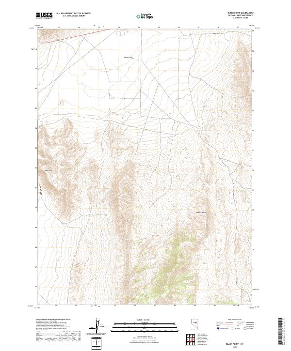
2021 Map of Black Point
USGS Topo · Published 2021About this map
Newark Valley dominates the northern expanse of this high-altitude landscape in White Pine County, where the transition from flat basin floor to complex relief is defined by the Black Point formation. The topography reveals the intricate drainage patterns and elevation changes characteristic of the Great Basin, centered on the prominent ridgelines of the Pancake Range. Section lines of the Public Land Survey System, including t17n r54e, t17n r55e, t16n r54e, and t16n r55e, provide a rigorous grid for modern land management across this terrain. This data serves as a precise record of the land surface before contemporary environmental shifts or development might alter the dry washes and alluvial fans that shape the basin's edges.
Find a feature on this map
7 named features on this map. Tap any name to fly to it.
Don’t see what you’re looking for? This feature index may not catch every label — zoom into the map to look around manually.
Map Details
Editions of this 2021 Black Point Map
This is the sole edition of this map. No revisions or reprints were ever made.
Other maps of this area

1951 · Green Springs
USGS Topo · 1:62,500

1951 · Pancake Summit
USGS Topo · 1:62,500

1953 · Pinto Summit
USGS Topo · 1:62,500

1956 · Ely
USGS Topo · 1:250,000

1959 · Ely
USGS Topo · 1:250,000

1963 · Ely
USGS Topo · 1:250,000

1964 · Moody Peak
USGS Topo · 1:62,500

1979 · Mt. Hamilton
USGS Topo · 1:100,000

1990 · Pancake Summit SW
USGS Topo · 1:24,000
1990 · Green Springs NW
USGS Topo · 1:24,000