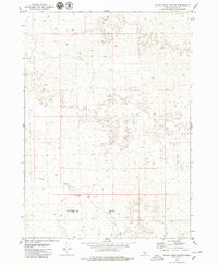
1979 Map of Black Ridge Crater
USGS Topo · Published 1979About this map
Black Ridge Crater and the surrounding volcanic landscape of Lincoln County dominate this late-1970s topographic study. The terrain is defined by its isolation and specialized geographic features, notably the Black Ridge Caves located just north of the crater. Human presence is sparse, marked primarily by a network of unimproved paths including a prominent Jeep Trail and various other seasonal tracks that traverse the high desert floor. Aside from the Black Ridge Well, which indicates essential water access in an otherwise arid environment, the map shows very little modern development, preserving the area's mid-century character. This survey provides a precise look at the township and range lines as they intersect this specific geological formation before subsequent decades of land use.
Find a feature on this map
11 named features on this map. Tap any name to fly to it.
Don’t see what you’re looking for? This feature index may not catch every label — zoom into the map to look around manually.
Map Details
Editions of this 1979 Black Ridge Crater Map
This is the sole edition of this map. No revisions or reprints were ever made.
Other maps of this area

1954 · Pocatello
USGS Topo · 1:250,000

1955 · Idaho Falls
USGS Topo · 1:250,000

1955 · Twin Falls
USGS Topo · 1:250,000

1955 · Hailey
USGS Topo · 1:250,000

1958 · Twin Falls
USGS Topo · 1:250,000

1958 · Idaho Falls
USGS Topo · 1:250,000

1958 · Pocatello
USGS Topo · 1:250,000

1959 · Hailey
USGS Topo · 1:250,000

1962 · Hailey
USGS Topo · 1:250,000

1971 · Owinza
USGS Topo · 1:24,000