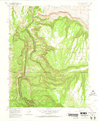
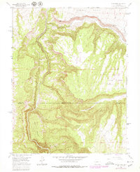
1955 Map of Black Ridge
USGS Topo · Published 1969About this map
The Black Canyon of the Gunnison dominates this mid-century survey, revealing the deep, shadowed chasm where the Gunnison River carves through the Colorado landscape. To the east, the plateau of Fruitland Mesa represents the agricultural character of the era, supported by an intricate system of water management including the Scenic Mesa Ditch and the Fruitland Mesa Ditch.
Find a feature on this map
18 named features on this map. Tap any name to fly to it.
Don’t see what you’re looking for? This feature index may not catch every label — zoom into the map to look around manually.
Map Details
Editions of this 1955 Black Ridge Map
6 editions found
Other maps of this area

1955 · Olathe NW
USGS Topo · 1:24,000

1955 · Black Ridge
USGS Topo · 1:24,000

1955 · Olathe
USGS Topo · 1:24,000

1955 · Red Rock Canyon
USGS Topo · 1:24,000

1955 · Lazear
USGS Topo · 1:24,000

1956 · Montrose
USGS Topo · 1:250,000

1957 · Grizzly Ridge
USGS Topo · 1:24,000

1959 · Montrose
USGS Topo · 1:250,000

1960 · Montrose
USGS Topo · 1:250,000
1962 · Orchard City
USGS Topo · 1:24,000