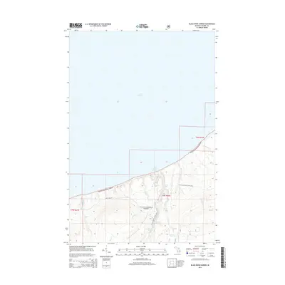
2014 Map of Black River Harbor
USGS Topo · Published 2014About this map
Black River Harbor serves as the focal point for this survey of Michigan’s western Upper Peninsula shoreline, where the Black River empties into Lake Superior. This landscape is defined by the heavy concentration of waterfalls along the river corridor within the Ottawa National Forest. The map documents a sequence of natural cataracts including Potawatomi Falls, Great Conglomerate Falls, Gorge Falls, and Rainbow Falls, many of which are accessible via the N Country National Scenic Trail. Away from the main river, smaller drainage systems like Maple Cr and Chickadee Cr carve through the wooded terrain. The interior is largely roadless, with Maple Creek Rd providing one of the few vehicle access points to this section of the Gogebic County coast.
Find a feature on this map
24 named features on this map. Tap any name to fly to it.
Don’t see what you’re looking for? This feature index may not catch every label — zoom into the map to look around manually.
Map Details
Editions of this 2014 Black River Harbor Map
This is the sole edition of this map. No revisions or reprints were ever made.
Other maps of this area

1953 · Ashland
USGS Topo · 1:250,000

1956 · Carp River
USGS Topo · 1:62,500

1956 · North Ironwood
USGS Topo · 1:62,500

1956 · Thomaston
USGS Topo · 1:62,500

1958 · Ashland
USGS Topo · 1:250,000

1958 · Iron River
USGS Topo · 1:250,000

1960 · Iron River
USGS Topo · 1:250,000

1961 · Iron River
USGS Topo · 1:250,000

1967 · Iron River
USGS Topo · 1:250,000

1979 · Ontonagon
USGS Topo · 1:100,000