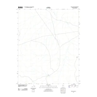
2011 Map of Black Tank
USGS Topo · Published 2011About this map
Black Tank Camp stands as a primary point of human presence in this high-desert portion of Coconino County, surrounded by a complex network of ephemeral drainage and water management sites. The landscape is defined by its arid character, where the topography necessitates scattered catchments like Little Sullivan Tank, Nelson Tank, and the namesake Black Tank itself. These water sources are vital markers for ranching or land management in an area dominated by features such as Long Point and the winding course of Farm Dam Draw. The map reveals a remote environment where survival and navigation are dictated by the few named water locations and the subtle changes in elevation across the plateau.
Find a feature on this map
6 named features on this map. Tap any name to fly to it.
Don’t see what you’re looking for? This feature index may not catch every label — zoom into the map to look around manually.
Map Details
Editions of this 2011 Black Tank Map
This is the sole edition of this map. No revisions or reprints were ever made.
Other maps of this area

1886 · Chino
USGS Topo · 1:250,000

1891 · Chino
USGS Topo · 1:250,000

1948 · Williams
USGS Topo · 1:250,000

1954 · Williams
USGS Topo · 1:250,000

1956 · Williams
USGS Topo · 1:250,000

1960 · Williams
USGS Topo · 1:250,000

1961 · Williams
USGS Topo · 1:250,000

1980 · Hazen Hole Tank
USGS Topo · 1:24,000
1980 · Tin House
USGS Topo · 1:24,000
1980 · Black Tank
USGS Topo · 1:24,000