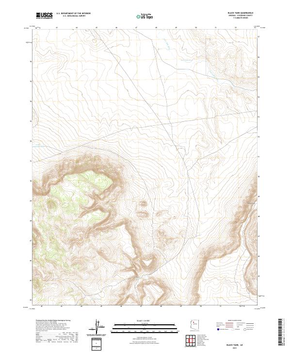
2021 Map of Black Tank
USGS Topo · Published 2021About this map
Farm Dam Draw meanders through this portion of Coconino County, characterizing a landscape defined by intermittent water sources and high-desert drainage patterns. The topography is marked by significant elevation changes, most notably at Long Point, where the terrain drops sharply toward the surrounding basins. In this arid environment, water management is essential to the local utility of the land, as evidenced by several named collection points. Black Tank, Little Sullivan Tank, and Nelson Tank represent the scattered reliable water features that have historically supported ranching or transit in this northern Arizona region. The map provides a clear look at the township and range divisions, including the intersection of t27n r4w and t26n r3w, which delineate property and land-use boundaries in this sparsely populated territory.
Find a feature on this map
9 named features on this map. Tap any name to fly to it.
Don’t see what you’re looking for? This feature index may not catch every label — zoom into the map to look around manually.
Map Details
Editions of this 2021 Black Tank Map
This is the sole edition of this map. No revisions or reprints were ever made.
Other maps of this area

1886 · Chino
USGS Topo · 1:250,000

1891 · Chino
USGS Topo · 1:250,000

1948 · Williams
USGS Topo · 1:250,000

1954 · Williams
USGS Topo · 1:250,000

1956 · Williams
USGS Topo · 1:250,000

1960 · Williams
USGS Topo · 1:250,000

1961 · Williams
USGS Topo · 1:250,000

1980 · Hazen Hole Tank
USGS Topo · 1:24,000
1980 · Tin House
USGS Topo · 1:24,000
1980 · Black Tank
USGS Topo · 1:24,000