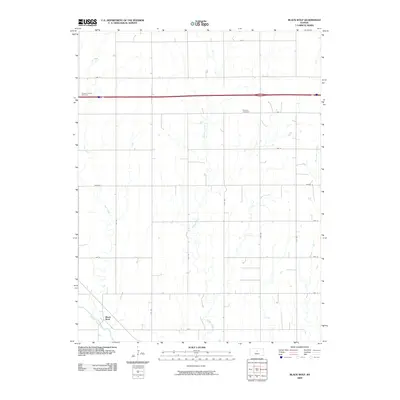
2009 Map of Black Wolf
USGS Topo · Published 2009About this map
The settlement of Black Wolf sits along the southern banks of the Smoky Hill River, serving as the primary landmark in this agricultural section of Ellsworth County. This 2009 survey highlights a classic Great Plains section-line road network, where labeled routes like 10th Rd and Ave I divide the landscape into a precise grid of fields and pastures. The terrain is defined by several riparian corridors, most notably Buffalo Creek and Cow Creek, which meander southward toward their confluence with the river.
Find a feature on this map
23 named features on this map. Tap any name to fly to it.
Don’t see what you’re looking for? This feature index may not catch every label — zoom into the map to look around manually.
Map Details
Editions of this 2009 Black Wolf Map
This is the sole edition of this map. No revisions or reprints were ever made.
Other maps of this area

1894 · Ellsworth
USGS Topo · 1:125,000

1955 · Great Bend
USGS Topo · 1:250,000

1956 · Wilson
USGS Topo · 1:24,000

1957 · Great Bend
USGS Topo · 1:250,000

1957 · Ellsworth
USGS Topo · 1:24,000

1957 · Westfall SW
USGS Topo · 1:24,000

1957 · Holyrood NE
USGS Topo · 1:24,000

1957 · Black Wolf
USGS Topo · 1:24,000

1958 · Great Bend
USGS Topo · 1:250,000
1964 · Wilson NW
USGS Topo · 1:24,000