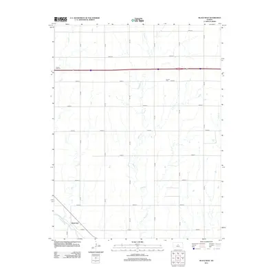
2012 Map of Black Wolf
USGS Topo · Published 2012About this map
Black Wolf occupies a quiet bend of the Smoky Hill River in Ellsworth County, where the southern plains transition into a landscape shaped by several significant watercourses. The drainage of Buffalo Cr and Cow Cr dominates the central and western sections of this 2012 survey, defining the agricultural layout of the region. The map reveals a strictly organized section-line road network, including Avenue A through Avenue I, which provides a window into the land division that has governed this part of Kansas for generations.
Find a feature on this map
22 named features on this map. Tap any name to fly to it.
Don’t see what you’re looking for? This feature index may not catch every label — zoom into the map to look around manually.
Map Details
Editions of this 2012 Black Wolf Map
This is the sole edition of this map. No revisions or reprints were ever made.
Other maps of this area

1894 · Ellsworth
USGS Topo · 1:125,000

1955 · Great Bend
USGS Topo · 1:250,000

1956 · Wilson
USGS Topo · 1:24,000

1957 · Great Bend
USGS Topo · 1:250,000

1957 · Ellsworth
USGS Topo · 1:24,000

1957 · Westfall SW
USGS Topo · 1:24,000

1957 · Holyrood NE
USGS Topo · 1:24,000

1957 · Black Wolf
USGS Topo · 1:24,000

1958 · Great Bend
USGS Topo · 1:250,000
1964 · Wilson NW
USGS Topo · 1:24,000