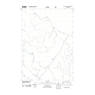
2011 Map of Blackbird Creek
USGS Topo · Published 2011About this map
Blackbird Mines and the Cobalt Mine define this mineral-rich pocket of Lemhi County, reflecting a landscape shaped by industrial extraction in the Salmon River Mountains. The presence of the Blackbird Tailings Dam along Blackbird Creek indicates the significant scale of processing operations that occurred here. A complex network of National Forest roads, including Nat For Dev Rd 116 and Blackbird Creek Rd, provides access through the deep drainage basins of Panther Creek and its many tributaries.
Find a feature on this map
29 named features on this map. Tap any name to fly to it.
Don’t see what you’re looking for? This feature index may not catch every label — zoom into the map to look around manually.
Map Details
Editions of this 2011 Blackbird Creek Map
This is the sole edition of this map. No revisions or reprints were ever made.
Other maps of this area

1950 · Blackbird Mtn
USGS Topo · 1:62,500

1950 · Leesburg
USGS Topo · 1:62,500

1951 · Leesburg
USGS Topo · 1:62,500

1951 · Blackbird Mtn
USGS Topo · 1:62,500

1956 · Elk City
USGS Topo · 1:250,000

1957 · Challis
USGS Topo · 1:250,000

1960 · Elk City
USGS Topo · 1:250,000

1960 · Challis
USGS Topo · 1:250,000

1963 · Challis
USGS Topo · 1:250,000
1963 · Opal Lake
USGS Topo · 1:24,000