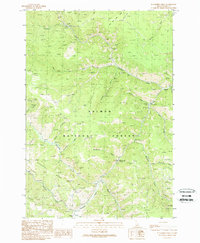
1989 Map of Blackbird Creek
USGS Topo · Published 1989About this map
Blackbird Mine anchors the northern drainage of this section of the Salmon National Forest, where steep drainages and ridge systems define the geography of the late 1980s. The landscape is marked by industrial and service outposts like the Cobalt F S Sta and the Cobalt Heliport, signaling the active management and extraction history of the area. A network of prospects, adits, and tailings sites are concentrated along Blackbird Creek and its tributaries, while the former settlement at Forney (Site) sits at the southern edge near Sawmill Gulch. The map records a complex terrain of named ridges such as Porphyry Ridge and Trans Line Ridge, which separate the various creek systems including Panther Creek and Musgrove Creek. Recreational and communication infrastructure is also present, from the McDonald Flat Campground to a Radio Tower overlooking the Musgrove Mine.
Find a feature on this map
36 named features on this map. Tap any name to fly to it.
Don’t see what you’re looking for? This feature index may not catch every label — zoom into the map to look around manually.
Map Details
Editions of this 1989 Blackbird Creek Map
This is the sole edition of this map. No revisions or reprints were ever made.
Other maps of this area

1950 · Blackbird Mtn
USGS Topo · 1:62,500

1950 · Leesburg
USGS Topo · 1:62,500

1951 · Leesburg
USGS Topo · 1:62,500

1951 · Blackbird Mtn
USGS Topo · 1:62,500

1956 · Elk City
USGS Topo · 1:250,000

1957 · Challis
USGS Topo · 1:250,000

1960 · Elk City
USGS Topo · 1:250,000

1960 · Challis
USGS Topo · 1:250,000

1963 · Challis
USGS Topo · 1:250,000
1963 · Opal Lake
USGS Topo · 1:24,000