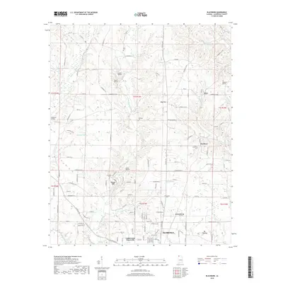
2018 Map of Blackburn
USGS Topo · Published 2018About this map
Cypress Creek and its many winding tributaries like Little Cypress Creek dominate the landscape of northern Lauderdale County in this 2018 survey. The map details a transition from the agricultural plateaus and hollows of the north, featuring named depressions like Wildcat Hollow and Savannah Hollow, to the expanding residential outskirts of Florence. This era shows a network of established small communities, from the northern crossroads of Zip City and Hines to the southern developed areas of Underwood-Petersville and St. Florian. Genealogy researchers can find several burial sites including Richardson Cem, Nolen Cem, and Chisholm Cem. The presence of Sharps Mill and various branches like Bonner Br and Posey Br illustrates the historical reliance on these waterways for local industry and drainage in this part of Alabama.
Find a feature on this map
141 named features on this map. Tap any name to fly to it.
Don’t see what you’re looking for? This feature index may not catch every label — zoom into the map to look around manually.
Map Details
Editions of this 2018 Blackburn Map
This is the sole edition of this map. No revisions or reprints were ever made.
Other maps of this area

1905 · Waynesboro
USGS Topo · 1:125,000

1914 · Muscle Shoals
USGS Topo · 1:48,000

1916 · Muscle Shoals
USGS Topo · 1:62,500

1924 · Gravelly Springs
USGS Topo · 1:48,000

1926 · Gravelly Springs
USGS Topo · 1:62,500

1936 · Light
USGS Topo · 1:24,000

1936 · Threet
USGS Topo · 1:24,000

1936 · Cypress Inn
USGS Topo · 1:24,000

1936 · Pruitton
USGS Topo · 1:24,000

1936 · Florence
USGS Topo · 1:24,000