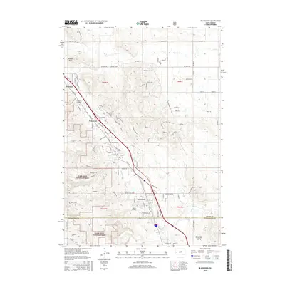
2015 Map of Blackhawk
USGS Topo · Published 2015About this map
Piedmont Butte stands as a prominent landmark overlooking the transition from the high plains into the eastern front of the Black Hills National Forest. This 2015 survey documents the suburban expansion of the northern Rapid City area, where modern residential developments like Summerset and Blackhawk are mapped in detail alongside older topographical features. The landscape is defined by its deep drainage systems, including Stagebarn Canyon and Wards Canyon, which channel seasonal water toward Elk Creek and Boxelder Creek. Genealogists and local historians will find value in the precise location of the Blackhawk Cem and the complex network of established roads such as Sturgis Rd and Peaceful Pines Rd that connect these growing communities across the Meade and Pennington county line.
Find a feature on this map
49 named features on this map. Tap any name to fly to it.
Don’t see what you’re looking for? This feature index may not catch every label — zoom into the map to look around manually.
Map Details
Editions of this 2015 Blackhawk Map
This is the sole edition of this map. No revisions or reprints were ever made.
Other maps of this area

1893 · Rapid
USGS Topo · 1:125,000

1898 · Rapid
USGS Topo · 1:125,000

1903 · Rapid
USGS Topo · 1:125,000

1953 · Rapid City 1 SW
USGS Topo · 1:24,000

1953 · Blackhawk
USGS Topo · 1:24,000

1953 · Rapid City East
USGS Topo · 1:24,000

1953 · Piedmont
USGS Topo · 1:24,000

1953 · Rapid City NW
USGS Topo · 1:24,000

1953 · Rapid City West
USGS Topo · 1:24,000
1953 · Tilford
USGS Topo · 1:24,000