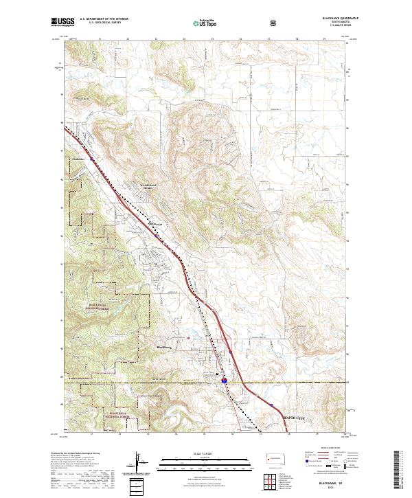
2021 Map of Blackhawk
USGS Topo · Published 2021About this map
Black Hills National Forest land meets the growing residential corridors of the eastern hills, showcasing a landscape defined by both dramatic topography and modern expansion. The terrain is marked by significant features like Piedmont Butte and the winding depths of Stagebarn Canyon, while the communities of Piedmont, Summerset, and Blackhawk align along the primary transportation routes. This era of the map documents the suburban development at Wonderland Homes and the proximity of the Meade Co and Pennington Co line near the northern reaches of Rapid City.
Find a feature on this map
123 named features on this map. Tap any name to fly to it.
Don’t see what you’re looking for? This feature index may not catch every label — zoom into the map to look around manually.
Map Details
Editions of this 2021 Blackhawk Map
This is the sole edition of this map. No revisions or reprints were ever made.
Other maps of this area

1893 · Rapid
USGS Topo · 1:125,000

1898 · Rapid
USGS Topo · 1:125,000

1903 · Rapid
USGS Topo · 1:125,000

1953 · Rapid City 1 SW
USGS Topo · 1:24,000

1953 · Blackhawk
USGS Topo · 1:24,000

1953 · Rapid City East
USGS Topo · 1:24,000

1953 · Piedmont
USGS Topo · 1:24,000

1953 · Rapid City NW
USGS Topo · 1:24,000

1953 · Rapid City West
USGS Topo · 1:24,000
1953 · Tilford
USGS Topo · 1:24,000