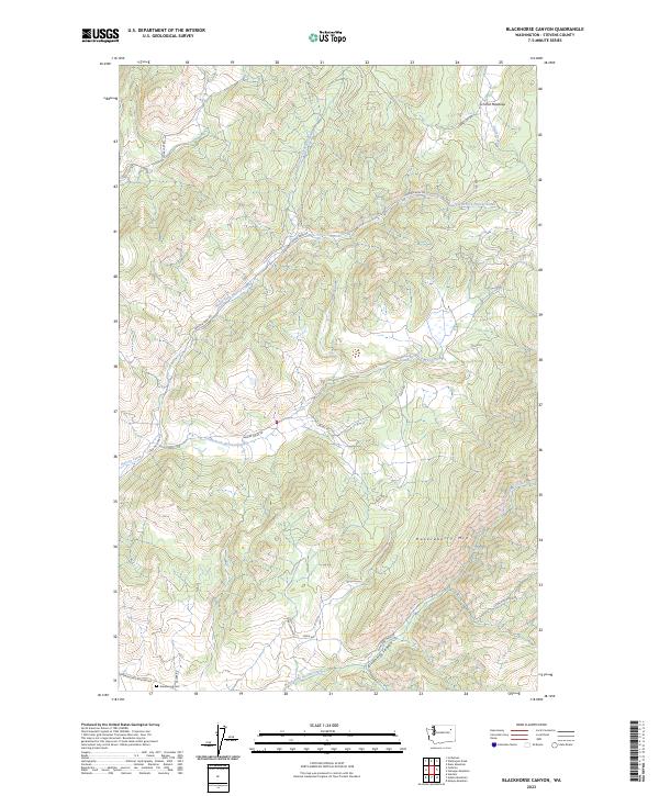
2023 Map of Blackhorse Canyon
USGS Topo · Published 2023About this map
Huckleberry Mtn anchors this section of Stevens County, defining a landscape of high drainages and forest access routes. The map detail highlights the complex branching of local waterways, including North Fork Harvey Creek and the headwaters of North Fork Hunter Creek that carve through Blackhorse Canyon. Human presence is marked by a network of rural roads such as Cedonia-Addy Rd and Harvey Creek Rd, which provide access to higher elevations and features like Schmid Meadows. In the southern portion of the quadrangle, Greenwood Cem sits near the junction of Springdale Hunters Rd and Selder Rd, serving as a primary point of interest for genealogists tracking family history in this corner of Washington. The inclusion of Cleveland Mine Rd points toward the area's legacy of resource extraction along the slopes.
Find a feature on this map
27 named features on this map. Tap any name to fly to it.
Don’t see what you’re looking for? This feature index may not catch every label — zoom into the map to look around manually.
Map Details
Editions of this 2023 Blackhorse Canyon Map
This is the sole edition of this map. No revisions or reprints were ever made.
Other maps of this area

1927 · Chewelah
USGS Topo · 1:125,000

1930 · Chewelah
USGS Topo · 1:125,000

1948 · Hunters
USGS Topo · 1:62,500

1950 · Hunters
USGS Topo · 1:62,500

1950 · Inchelium
USGS Topo · 1:62,500

1954 · Okanogan
USGS Topo · 1:250,000

1958 · Okanogan
USGS Topo · 1:250,000

1958 · Sandpoint
USGS Topo · 1:250,000

1963 · Sandpoint
USGS Topo · 1:250,000
1965 · Empey Mountain
USGS Topo · 1:24,000