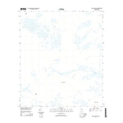
2014 Map of Blackjack Island
USGS Topo · Published 2014About this map
Blackjack Island and the surrounding labyrinthine wetlands of Ware County dominate this 2014 survey. The landscape is characterized by a complex network of island landforms and seasonal water bodies, including the elongated Blackjack Lake. This portion of the Georgia interior shows a terrain almost entirely devoid of modern infrastructure, preserving the natural hydrological patterns of the region. Distinctive named features like Honey Island to the north and Sandy Island to the southwest provide critical navigational points within the shifting swamp environment. Further south, Mitchell Island marks a transition in the marshy expanse. The absence of roads and settlements throughout the quadrangle highlights the enduring isolation of these wetlands, making it a primary resource for studying the untouched topography of southern Georgia's island-and-marsh systems.
Find a feature on this map
5 named features on this map. Tap any name to fly to it.
Don’t see what you’re looking for? This feature index may not catch every label — zoom into the map to look around manually.
Map Details
Editions of this 2014 Blackjack Island Map
This is the sole edition of this map. No revisions or reprints were ever made.
Other maps of this area

1918 · Folkston
USGS Topo · 1:62,500

1918 · Moniac
USGS Topo · 1:62,500

1942 · Moniac
USGS Topo · 1:62,500

1954 · Valdosta
USGS Topo · 1:250,000

1956 · Eddy
USGS Topo · 1:24,000

1956 · Sargent
USGS Topo · 1:24,000

1958 · Valdosta
USGS Topo · 1:250,000

1959 · Valdosta
USGS Topo · 1:250,000

1965 · Chesser Island
USGS Topo · 1:24,000

1965 · Chase Prairie
USGS Topo · 1:24,000