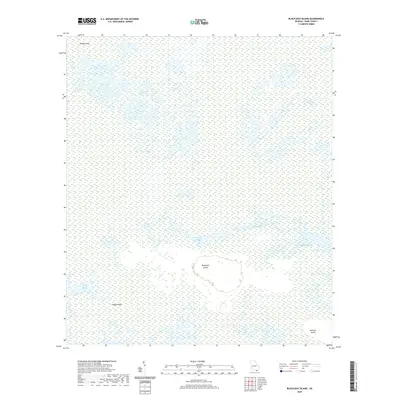
2020 Map of Blackjack Island
USGS Topo · Published 2020About this map
Blackjack Island stands as a prominent terrain feature within the sprawling wetlands of the Okefenokee Swamp in southern Georgia. This 2020 survey illustrates a landscape dominated by aquatic environments, where isolated islands like Honey Island and Sandy Island rise above a complex network of marshes and open water. The map documents distinct hydrologic zones including Honey Island Prairie, Blackjack Prairie, and Strange Island Prairie, which characterize the intricate ecology of the swamp basin. Unlike more developed regions, this area is defined by its lack of conventional road infrastructure, emphasizing its character as a protected natural wilderness. Small bodies of water such as Blackjack Lake are scattered throughout, while larger terrestrial features like Mitchell Island provide fixed points of reference within the shifting environment of the swamp.
Find a feature on this map
10 named features on this map. Tap any name to fly to it.
Don’t see what you’re looking for? This feature index may not catch every label — zoom into the map to look around manually.
Map Details
Editions of this 2020 Blackjack Island Map
This is the sole edition of this map. No revisions or reprints were ever made.
Other maps of this area

1918 · Folkston
USGS Topo · 1:62,500

1918 · Moniac
USGS Topo · 1:62,500

1942 · Moniac
USGS Topo · 1:62,500

1954 · Valdosta
USGS Topo · 1:250,000

1956 · Eddy
USGS Topo · 1:24,000

1956 · Sargent
USGS Topo · 1:24,000

1958 · Valdosta
USGS Topo · 1:250,000

1959 · Valdosta
USGS Topo · 1:250,000

1965 · Chesser Island
USGS Topo · 1:24,000

1965 · Chase Prairie
USGS Topo · 1:24,000