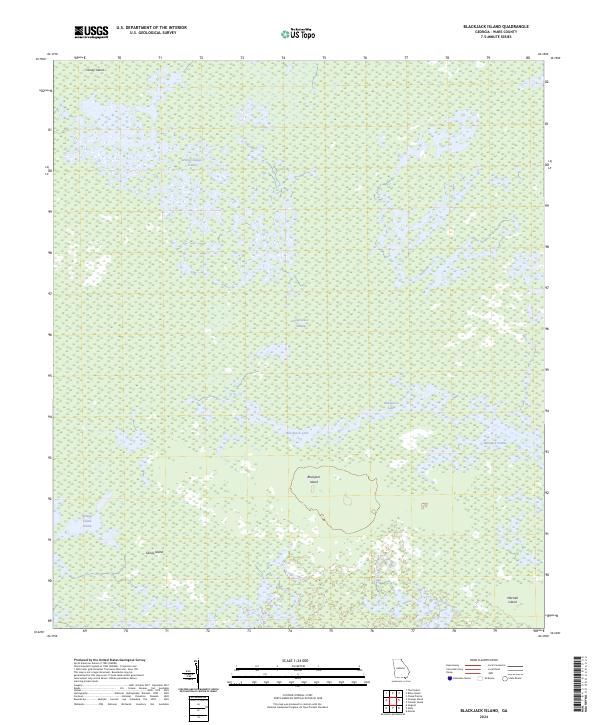
2024 Map of Blackjack Island
USGS Topo · Published 2024About this map
Okefenokee National Wildlife Refuge and the Okefenokee Wilderness dominate this detailed study of Ware County's interior wetlands. The landscape is defined by the intricate hydrology of the Okefenokee Swamp, where open water bodies like Blackjack Lake are interspersed with distinct island elevations and grassy prairies. These named landforms, such as Blackjack Island and Sandy Island, provided essential high ground for early travelers and hunters navigating the dense swamp environment. The mapping reveals a complex mosaic of marsh and solid ground, illustrating the natural barriers that have historically shaped local movement and preservation efforts in southern Georgia. Researchers can trace the boundaries of these ecosystems, from the expanse of Honey Island Prairie to the isolated reach of Mitchell Island at the southeastern edge of the sheet.
Find a feature on this map
11 named features on this map. Tap any name to fly to it.
Don’t see what you’re looking for? This feature index may not catch every label — zoom into the map to look around manually.
Map Details
Editions of this 2024 Blackjack Island Map
This is the sole edition of this map. No revisions or reprints were ever made.
Other maps of this area

1918 · Folkston
USGS Topo · 1:62,500

1918 · Moniac
USGS Topo · 1:62,500

1942 · Moniac
USGS Topo · 1:62,500

1954 · Valdosta
USGS Topo · 1:250,000

1956 · Eddy
USGS Topo · 1:24,000

1956 · Sargent
USGS Topo · 1:24,000

1958 · Valdosta
USGS Topo · 1:250,000

1959 · Valdosta
USGS Topo · 1:250,000

1965 · Chesser Island
USGS Topo · 1:24,000

1965 · Chase Prairie
USGS Topo · 1:24,000