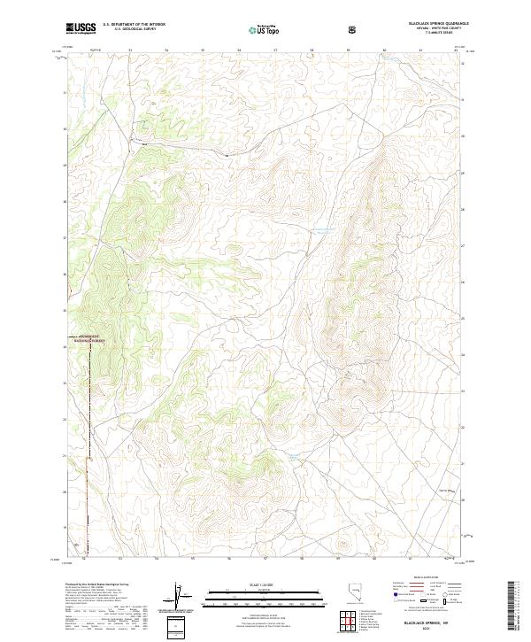
2021 Map of Blackjack Springs
USGS Topo · Published 2021About this map
Deadman Wash and Jakes Wash define the drainage patterns of this high-desert landscape within the Humboldt National Forest. The map documents the intricate topography of the Blackjack Springs quadrangle, where seasonal watercourses carve through the rugged terrain of White Pine County. Most of the land is defined by Public Land Survey System divisions, showing the grid-based allocation of territory across the eastern Nevada basin and range. The absence of developed settlements emphasizes the remote character of this forest land, where topographic detail and drainage features are the primary landmarks for navigation and land management. Researchers can examine the specific elevation contours that shape the north-south valleys and identifying ridges characteristic of the Great Basin geography.
Find a feature on this map
2 named features on this map. Tap any name to fly to it.
Don’t see what you’re looking for? This feature index may not catch every label — zoom into the map to look around manually.
Map Details
Editions of this 2021 Blackjack Springs Map
This is the sole edition of this map. No revisions or reprints were ever made.
Other maps of this area

1949 · Treasure Hill
USGS Topo · 1:62,500

1950 · Treasure Hill
USGS Topo · 1:62,500

1956 · Lund
USGS Topo · 1:250,000

1956 · Ely
USGS Topo · 1:250,000

1957 · Currant Mtn
USGS Topo · 1:62,500

1958 · Giroux Wash
USGS Topo · 1:24,000

1959 · Ely
USGS Topo · 1:250,000

1959 · Preston Reservoir
USGS Topo · 1:62,500

1960 · Lund
USGS Topo · 1:250,000

1963 · Ely
USGS Topo · 1:250,000