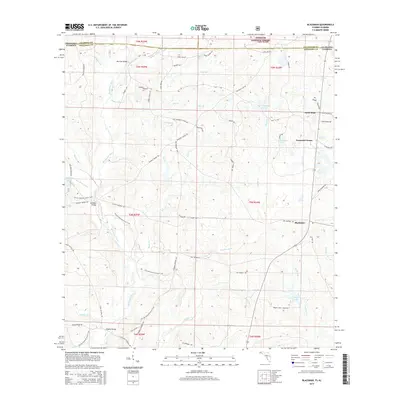
2015 Map of Blackman
USGS Topo · Published 2015About this map
The Blackwater River and its numerous tributaries, including Boggy Hollow Creek and Panther Creek, dominate this rural landscape along the Florida-Alabama border. The topography reflects a transition from the southern edge of the Conecuh National Forest into the agricultural and timber lands of northern Okaloosa County. Local connectivity is defined by historic crossings such as Kennedy Bridge and Peaden Bridge, alongside long-standing timber and farm roads named for local families, including Mattie Kennedy Rd and Tommie Steele Rd. Small rural hubs like Escambia Farms and Blackman serve as the primary points of settlement, while the Florida National Scenic Trail winds through the western half of the map, passing near Hurricane Lake. The presence of several large water bodies, such as Karick Lake and the E C Youngblood Pond, highlights the region's managed water resources and recreational spaces within the pine-dominated flatwoods.
Find a feature on this map
79 named features on this map. Tap any name to fly to it.
Don’t see what you’re looking for? This feature index may not catch every label — zoom into the map to look around manually.
Map Details
Editions of this 2015 Blackman Map
This is the sole edition of this map. No revisions or reprints were ever made.
Other maps of this area

1948 · Munson
USGS Topo · 1:62,500

1949 · Crestview
USGS Topo · 1:62,500

1950 · Munson
USGS Topo · 1:62,500

1951 · Crestview
USGS Topo · 1:62,500

1953 · Andalusia
USGS Topo · 1:250,000

1957 · Andalusia
USGS Topo · 1:250,000

1957 · Pensacola
USGS Topo · 1:250,000

1959 · Pensacola
USGS Topo · 1:250,000

1960 · Pensacola
USGS Topo · 1:250,000

1971 · Bradley
USGS Topo · 1:24,000