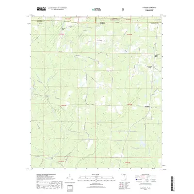
2018 Map of Blackman
USGS Topo · Published 2018About this map
Escambia Farms and the settlement of Blackman anchor this northern Florida landscape, where the Okaloosa and Escambia county lines meet the Alabama state border. The terrain is defined by the winding course of the Blackwater River, which is fed by numerous tributaries including Alligator Br and Middle Cr. This 2018 survey reveals a network of rural routes named for local families, such as Mattie Kennedy Rd and Dilmore Rd, tracing the residential and agricultural development of the region.
Find a feature on this map
82 named features on this map. Tap any name to fly to it.
Don’t see what you’re looking for? This feature index may not catch every label — zoom into the map to look around manually.
Map Details
Editions of this 2018 Blackman Map
This is the sole edition of this map. No revisions or reprints were ever made.
Other maps of this area

1948 · Munson
USGS Topo · 1:62,500

1949 · Crestview
USGS Topo · 1:62,500

1950 · Munson
USGS Topo · 1:62,500

1951 · Crestview
USGS Topo · 1:62,500

1953 · Andalusia
USGS Topo · 1:250,000

1957 · Andalusia
USGS Topo · 1:250,000

1957 · Pensacola
USGS Topo · 1:250,000

1959 · Pensacola
USGS Topo · 1:250,000

1960 · Pensacola
USGS Topo · 1:250,000

1971 · Bradley
USGS Topo · 1:24,000