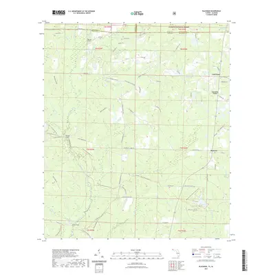
2021 Map of Blackman
USGS Topo · Published 2021About this map
The Blackwater River and its numerous tributaries, including Hurricane Creek and Panther Creek, dictate the movement and settlement of this borderland region between Florida and Alabama. Small agricultural communities such as Escambia Farms, Blackman, and Good Hope are linked by a network of local roads and distinctive river crossings like Peaden Bridge and Red Oak Bridge. The landscape is a mix of managed forest and riparian corridors, with the Conecuh National Forest reaching across the state line from the north.
Find a feature on this map
91 named features on this map. Tap any name to fly to it.
Don’t see what you’re looking for? This feature index may not catch every label — zoom into the map to look around manually.
Map Details
Editions of this 2021 Blackman Map
This is the sole edition of this map. No revisions or reprints were ever made.
Other maps of this area

1948 · Munson
USGS Topo · 1:62,500

1949 · Crestview
USGS Topo · 1:62,500

1950 · Munson
USGS Topo · 1:62,500

1951 · Crestview
USGS Topo · 1:62,500

1953 · Andalusia
USGS Topo · 1:250,000

1957 · Andalusia
USGS Topo · 1:250,000

1957 · Pensacola
USGS Topo · 1:250,000

1959 · Pensacola
USGS Topo · 1:250,000

1960 · Pensacola
USGS Topo · 1:250,000

1971 · Bradley
USGS Topo · 1:24,000