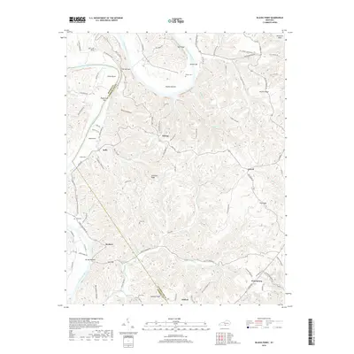
2019 Map of Blacks Ferry
USGS Topo · Published 2019About this map
The Cumberland River carves a dramatic path through this southern Kentucky landscape, forming distinctive loops at Salt Lick Bend, Elbow Bend, and Herefords Bend. The terrain is defined by narrow ridges and deep hollows, with the river's influence seen in names like The Narrows, Wilburn Bar, and Biggerstaff Bar. Settlement is scattered across high ground and along creek valleys, with communities like Stalcup, Littrell, and Peytonsburg serving as local anchors. Genealogists can find several small family burial grounds, including Philpot Cem, Jones Cem, and Short Cem. The local economy and geography are tied to the water, as evidenced by Judio Flats and the numerous named branches feeding into Kettle Creek, such as Mary Scott Br and Wells Cr.
Find a feature on this map
106 named features on this map. Tap any name to fly to it.
Don’t see what you’re looking for? This feature index may not catch every label — zoom into the map to look around manually.
Map Details
Editions of this 2019 Blacks Ferry Map
This is the sole edition of this map. No revisions or reprints were ever made.
Other maps of this area

1924 · Lillydale
USGS Topo · 1:62,500

1926 · Lillydale
USGS Topo · 1:62,500

1929 · Lillydale
USGS Topo · 1:62,500

1929 · Tompkinsville
USGS Topo · 1:62,500

1953 · Waterview
USGS Topo · 1:24,000

1953 · Burkesville
USGS Topo · 1:24,000

1953 · Dubre
USGS Topo · 1:24,000

1954 · Frogue
USGS Topo · 1:24,000

1954 · Blacks Ferry
USGS Topo · 1:24,000
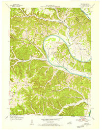
1954 · Vernon
USGS Topo · 1:24,000