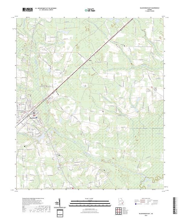
2024 Map of Blackshear East
USGS Topo · Published 2024About this map
The Pierce County Courthouse stands as the civic anchor of Blackshear, Georgia, in a landscape where the dense street grid of the county seat quickly gives way to the wetlands of the coastal plain. The Alabaha River and the Satilla River wind through the southern and eastern reaches of the area, creating a complex network of drainage that includes Raulerson Swamp and Mud Swamp. This environment has historically dictated the placement of rural settlements and family-named landmarks, as seen in the cluster of small communities and crossroads like Owen and Otter Creek.
Find a feature on this map
146 named features on this map. Tap any name to fly to it.
Don’t see what you’re looking for? This feature index may not catch every label — zoom into the map to look around manually.
Map Details
Editions of this 2024 Blackshear East Map
This is the sole edition of this map. No revisions or reprints were ever made.
Other maps of this area

1953 · Waycross
USGS Topo · 1:250,000

1958 · Waycross
USGS Topo · 1:250,000
1966 · Hoboken East
USGS Topo · 1:24,000

1967 · Hoboken West
USGS Topo · 1:24,000

1967 · Waycross East
USGS Topo · 1:24,000

1971 · Blackshear East
USGS Topo · 1:24,000

1971 · Patterson
USGS Topo · 1:24,000
1971 · Screven
USGS Topo · 1:24,000

1971 · Blackshear West
USGS Topo · 1:24,000

1971 · Mershon
USGS Topo · 1:24,000