
1967 Map of Waycross East
USGS Topo · Published 1969About this map
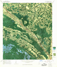
Waycross serves as a dense urban core on this 1960s survey, defined by its complex grid of streets like Albany Ave and Carswell St. The town is a major regional hub for education and medicine, home to the Univ of Georgia (Off Campus Center), St Josephs Academy, and Memorial Hospital. Industry and infrastructure are prominent, with the Seaboard Coast Line railroad bisecting the landscape and the Filtration Plant and Sewage Disposal facility supporting the growing population.
Find a feature on this map
96 named features on this map. Tap any name to fly to it.
Don’t see what you’re looking for? This feature index may not catch every label — zoom into the map to look around manually.
Map Details
Editions of this 1967 Waycross East Map
This is the sole edition of this map. No revisions or reprints were ever made.
Other maps of this area

1953 · Waycross
USGS Topo · 1:250,000

1958 · Waycross
USGS Topo · 1:250,000

1967 · Waycross SE
USGS Topo · 1:24,000
1967 · Fort Mudge
USGS Topo · 1:24,000

1967 · Hoboken West
USGS Topo · 1:24,000

1967 · Waycross West
USGS Topo · 1:24,000

1967 · Waycross SW
USGS Topo · 1:24,000

1971 · Dixie Union
USGS Topo · 1:24,000

1971 · Blackshear East
USGS Topo · 1:24,000

1971 · Blackshear West
USGS Topo · 1:24,000