
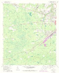
1967 Map of Waycross West
USGS Topo · Published 1969About this map
The Seaboard Coast Line railroad creates a sharp diagonal across this South Georgia landscape, connecting the regional hub of Waycross to outlying settlements like Waresboro and Ruskin. The western fringes of the city are characterized by a transition from dense institutional footprints, such as the Waycross-Ware County Airport and the Waycross Vocational Technical School, to the vast, water-saturated expanses of Cloughs Bay and Musket Bay.
Find a feature on this map
48 named features on this map. Tap any name to fly to it.
Don’t see what you’re looking for? This feature index may not catch every label — zoom into the map to look around manually.
Map Details
Editions of this 1967 Waycross West Map
2 editions found
Other maps of this area

1953 · Waycross
USGS Topo · 1:250,000

1958 · Waycross
USGS Topo · 1:250,000

1967 · Waycross SE
USGS Topo · 1:24,000

1967 · Pine Valley
USGS Topo · 1:24,000

1967 · Waycross East
USGS Topo · 1:24,000

1967 · Waycross SW
USGS Topo · 1:24,000

1968 · Manor
USGS Topo · 1:24,000

1971 · Dixie Union
USGS Topo · 1:24,000

1971 · Talmo
USGS Topo · 1:24,000

1971 · Blackshear West
USGS Topo · 1:24,000