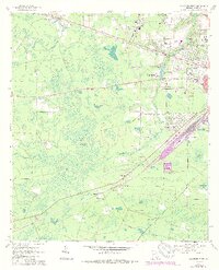
1967 Map of Waycross West
USGS Topo · Published 1988About this map
Waresboro and the expanding western fringes of Waycross define this landscape in the late 1960s, a period marked by both established community hubs and new development. The eastern side of the sheet shows a maturing suburban and institutional infrastructure, featuring the Waycross Ware Tech Sch, Baptist Village Nursing Home, and Winona Park. In contrast, the western half is dominated by the sprawling wetlands of Cloughs Bay and Musket Bay, where Lingerfelt Island rises as a distinct landmark within the swampy terrain.
Find a feature on this map
48 named features on this map. Tap any name to fly to it.
Don’t see what you’re looking for? This feature index may not catch every label — zoom into the map to look around manually.
Map Details
Editions of this 1967 Waycross West Map
2 editions found
Other maps of this area

1953 · Waycross
USGS Topo · 1:250,000

1958 · Waycross
USGS Topo · 1:250,000

1967 · Waycross SE
USGS Topo · 1:24,000

1967 · Waycross West
USGS Topo · 1:24,000

1967 · Pine Valley
USGS Topo · 1:24,000

1967 · Waycross East
USGS Topo · 1:24,000

1967 · Waycross SW
USGS Topo · 1:24,000

1968 · Manor
USGS Topo · 1:24,000

1971 · Dixie Union
USGS Topo · 1:24,000

1971 · Talmo
USGS Topo · 1:24,000