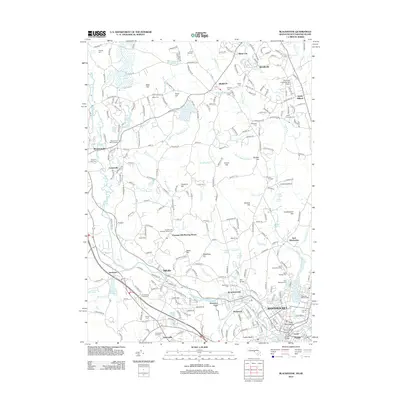
2012 Map of Blackstone
USGS Topo · Published 2012About this map
The Blackstone River carves through this landscape at the border of Massachusetts and Rhode Island, defining a region where industrial heritage meets suburban growth. The presence of the Waucantuck Mill Complex and the Blackstone Gorge speaks to the river's long history as an industrial power source. To the south, the city of Woonsocket and its residential neighborhoods like Hamlet and Social anchor the valley, while the northern reaches maintain a more agrarian character with sites like Wojcik Farm and Christiansens Orchards. Local history and genealogy are well-represented by numerous burial grounds, including the Chestnut Hill Meeting House Cem and several Catholic sites like Saint Michaels Cem. The Providence & Worcester RR continues to follow the river valley, connecting longstanding settlements such as Millville and Blackstone to the wider regional economy.
Find a feature on this map
270 named features on this map. Tap any name to fly to it.
Don’t see what you’re looking for? This feature index may not catch every label — zoom into the map to look around manually.
Map Details
Editions of this 2012 Blackstone Map
This is the sole edition of this map. No revisions or reprints were ever made.
Other maps of this area

1886 · Blackstone
USGS Topo · 1:62,500

1887 · Franklin
USGS Topo · 1:62,500

1887 · Providence
USGS Topo · 1:62,500

1889 · Providence
USGS Topo · 1:62,500

1889 · Blackstone
USGS Topo · 1:62,500

1889 · Franklin
USGS Topo · 1:62,500

1889 · Burrillville
USGS Topo · 1:62,500

1893 · Franklin
USGS Topo · 1:62,500

1893 · Blackstone
USGS Topo · 1:62,500

1894 · Burrillville
USGS Topo · 1:62,500