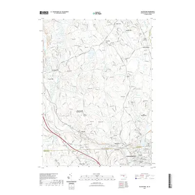
2021 Map of Blackstone
USGS Topo · Published 2021About this map
Woonsocket and the surrounding industrial valley form the southern anchor of this study, where the Blackstone River carves through the dramatic Blackstone Gorge. The landscape transitions from the dense urban grid of Social and Waterford into the highland terrain of Chestnut Hill and West Hill. This region is defined by its deep colonial and industrial roots, evidenced by the numerous small family and community burial grounds like the Almshouse Cem and the Silas Comstock Lot Cem. Transport history is visible in the path of the Southern New England Trunkline Trl, which follows the historic rail corridor connecting Millville and Blackstone. The map also highlights the preservation of early religious life at the Chestnut Hill Meeting House and the Quaker Meeting House, reflecting the diverse spiritual heritage of this borderland between Massachusetts and Rhode Island.
Find a feature on this map
263 named features on this map. Tap any name to fly to it.
Don’t see what you’re looking for? This feature index may not catch every label — zoom into the map to look around manually.
Map Details
Editions of this 2021 Blackstone Map
This is the sole edition of this map. No revisions or reprints were ever made.
Other maps of this area

1886 · Blackstone
USGS Topo · 1:62,500

1887 · Franklin
USGS Topo · 1:62,500

1887 · Providence
USGS Topo · 1:62,500

1889 · Providence
USGS Topo · 1:62,500

1889 · Blackstone
USGS Topo · 1:62,500

1889 · Franklin
USGS Topo · 1:62,500

1889 · Burrillville
USGS Topo · 1:62,500

1893 · Franklin
USGS Topo · 1:62,500

1893 · Blackstone
USGS Topo · 1:62,500

1894 · Burrillville
USGS Topo · 1:62,500