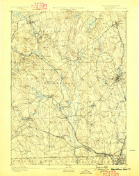
1893 Map of Blackstone
USGS Topo · Published 1898About this map
The Blackstone River valley in the late 19th century was a hub of industrial activity, where the river's descent powered a series of mill villages. This survey illustrates a landscape deeply integrated with the Providence and Worcester Railroad, which follows the river's path to connect manufacturing centers like Whitinsville, Uxbridge, and Millville. Beyond the riverbanks, the terrain rises into the characteristic highlands of central Massachusetts, featuring notable geological landmarks such as Purgatory Chasm and prominent elevations like Chestnut Hill and Keith Hill.
Find a feature on this map
104 named features on this map. Tap any name to fly to it.
Don’t see what you’re looking for? This feature index may not catch every label — zoom into the map to look around manually.
Map Details
Editions of this 1893 Blackstone Map
2 editions found

Other maps of this area

1885 · Worcester
USGS Topo · 1:62,500

1886 · Worcester
USGS Topo · 1:62,500

1886 · Blackstone
USGS Topo · 1:62,500

1886 · Framingham
USGS Topo · 1:62,500

1887 · Franklin
USGS Topo · 1:62,500

1887 · Providence
USGS Topo · 1:62,500

1887 · Marlboro
USGS Topo · 1:62,500

1889 · Providence
USGS Topo · 1:62,500

1889 · Marlboro
USGS Topo · 1:62,500

1889 · Blackstone
USGS Topo · 1:62,500