
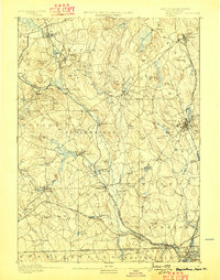
1893 Map of Blackstone
USGS Topo · Published 1893About this map
The Blackstone River corridor serves as the industrial and transit spine of this late 19th-century landscape, powering a dense network of mill towns and villages across the Massachusetts and Rhode Island border. This survey by Laurence Thompson and Sumner H. Bodfish documents a region defined by its water-powered economy, where the Mumford River and Quinsigamond River feed into a valley lined with manufacturing hubs like Whitinsville and Farnumsville. The industrial intensity is matched by a complex rail infrastructure, including the Providence and Worcester RR and the New York and New England Railroad, which bypassed older inland settlements in favor of the river valleys. Beyond the factory floors, the map reveals distinct geological and cultural landmarks, from the dramatic Purgatory Chasm to quiet rural outliers such as New England Village and Mendon. Family-named peaks like Keith Hill and George Hill overlook a landscape of reservoirs and ponds, such as Lackey Pond and Whitin Pond, that were critical to local mill operations.
Find a feature on this map
104 named features on this map. Tap any name to fly to it.
Don’t see what you’re looking for? This feature index may not catch every label — zoom into the map to look around manually.
Map Details
Editions of this 1893 Blackstone Map
2 editions found
Other maps of this area

1885 · Worcester
USGS Topo · 1:62,500

1886 · Worcester
USGS Topo · 1:62,500

1886 · Blackstone
USGS Topo · 1:62,500

1886 · Framingham
USGS Topo · 1:62,500

1887 · Franklin
USGS Topo · 1:62,500

1887 · Providence
USGS Topo · 1:62,500

1887 · Marlboro
USGS Topo · 1:62,500

1889 · Providence
USGS Topo · 1:62,500

1889 · Marlboro
USGS Topo · 1:62,500

1889 · Blackstone
USGS Topo · 1:62,500