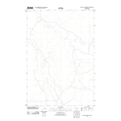
2011 Map of Blacktail Creek SW
USGS Topo · Published 2011About this map
Spring Creek and its southern branch, South Spring Creek, carve a complex drainage network through this portion of Powder River County. The landscape is defined by the intermittent flow of Dry Creek and Whitetail Creek, illustrating the seasonal water patterns characteristic of the Montana plains. Transportation across this open country is anchored by Powderville Rd, which cuts through the southern reaches of the map. This 2011 survey provides a precise record of the physical geography and road infrastructure in a sparsely populated region where topographic detail and water access are central to understanding land use and movement.
Find a feature on this map
5 named features on this map. Tap any name to fly to it.
Don’t see what you’re looking for? This feature index may not catch every label — zoom into the map to look around manually.
Map Details
Editions of this 2011 Blacktail Creek SW Map
This is the sole edition of this map. No revisions or reprints were ever made.
Other maps of this area

1954 · Ekalaka
USGS Topo · 1:250,000

1956 · Ekalaka
USGS Topo · 1:250,000

1958 · Ekalaka
USGS Topo · 1:250,000

1965 · Ekalaka
USGS Topo · 1:250,000

1979 · Blacktail Creek NW
USGS Topo · 1:24,000

1979 · Blacktail Creek SE
USGS Topo · 1:24,000
1979 · Mills Creek East
USGS Topo · 1:24,000

1979 · Board Corral Creek
USGS Topo · 1:24,000

1979 · Blacktail Creek SW
USGS Topo · 1:24,000

1979 · Powderville
USGS Topo · 1:24,000