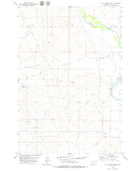
1979 Map of Mills Creek East
USGS Topo · Published 1979About this map
The Powder River meanders across the northeast corner of this Eastern Montana landscape, defining a wide valley of riparian vegetation and shifting sandbars. This late-1970s survey captures a sparsely settled cattle-ranching region centered around the small locality of Shaw. The terrain is deeply incised by a complex network of seasonal drainages, including the oddly named Third Ash Creek, Dead Horse Creek, and Mills Creek, which likely reflect the early naming conventions of local homesteaders and ranchers.
Find a feature on this map
13 named features on this map. Tap any name to fly to it.
Don’t see what you’re looking for? This feature index may not catch every label — zoom into the map to look around manually.
Map Details
Editions of this 1979 Mills Creek East Map
This is the sole edition of this map. No revisions or reprints were ever made.
Other maps of this area

1953 · Miles City
USGS Topo · 1:250,000

1954 · Ekalaka
USGS Topo · 1:250,000

1956 · Ekalaka
USGS Topo · 1:250,000

1957 · Miles City
USGS Topo · 1:250,000

1958 · Miles City
USGS Topo · 1:250,000

1958 · Ekalaka
USGS Topo · 1:250,000

1965 · Ekalaka
USGS Topo · 1:250,000

1969 · Tepee Butte
USGS Topo · 1:24,000
1969 · Bear Jaw Creek
USGS Topo · 1:24,000

1979 · Blacktail Creek NW
USGS Topo · 1:24,000