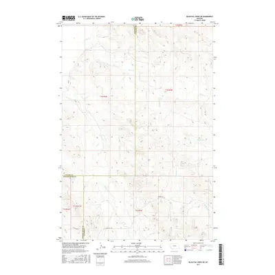
2017 Map of Blacktail Creek SW
USGS Topo · Published 2017About this map
The high plains of eastern Montana meet at the triple point of Powder River, Custer, and Carter Counties in this 2017 survey. The landscape is defined by the ephemeral drainages of the Powder River basin, most notably Whitetail Cr and the various branches of Spring Cr. These waterways carve through the terrain, creating a complex topography of ridges and draws that historically dictated the movement of livestock and travelers through this open country.
Find a feature on this map
17 named features on this map. Tap any name to fly to it.
Don’t see what you’re looking for? This feature index may not catch every label — zoom into the map to look around manually.
Map Details
Editions of this 2017 Blacktail Creek SW Map
This is the sole edition of this map. No revisions or reprints were ever made.
Other maps of this area

1954 · Ekalaka
USGS Topo · 1:250,000

1956 · Ekalaka
USGS Topo · 1:250,000

1958 · Ekalaka
USGS Topo · 1:250,000

1965 · Ekalaka
USGS Topo · 1:250,000

1979 · Blacktail Creek NW
USGS Topo · 1:24,000

1979 · Blacktail Creek SE
USGS Topo · 1:24,000
1979 · Mills Creek East
USGS Topo · 1:24,000

1979 · Board Corral Creek
USGS Topo · 1:24,000

1979 · Blacktail Creek SW
USGS Topo · 1:24,000

1979 · Powderville
USGS Topo · 1:24,000