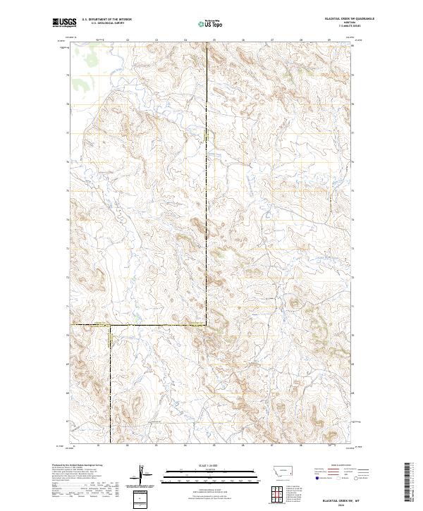
2024 Map of Blacktail Creek SW
USGS Topo · Published 2024About this map
Sparse drainage networks and remote ranching access define this landscape in southeastern Montana. The terrain is marked by the convergence of several ephemeral waterways, including Spring Creek and South Spring Creek, which cut through the broken topography. The map illustrates a critical geographic boundary where Custer, Powder River, and Carter Counties meet. Transportation across these high plains relies on established county routes such as Powderville Rd and Ekalaka Rd, which navigate the draws between Whitetail Creek and Dry Creek. This survey provides a precise view of the Public Land Survey System (PLSS) grid, documenting the township and range lines that have structured land ownership in this corner of the state for over a century.
Find a feature on this map
18 named features on this map. Tap any name to fly to it.
Don’t see what you’re looking for? This feature index may not catch every label — zoom into the map to look around manually.
Map Details
Editions of this 2024 Blacktail Creek SW Map
This is the sole edition of this map. No revisions or reprints were ever made.
Other maps of this area

1954 · Ekalaka
USGS Topo · 1:250,000

1956 · Ekalaka
USGS Topo · 1:250,000

1958 · Ekalaka
USGS Topo · 1:250,000

1965 · Ekalaka
USGS Topo · 1:250,000

1979 · Blacktail Creek NW
USGS Topo · 1:24,000

1979 · Blacktail Creek SE
USGS Topo · 1:24,000
1979 · Mills Creek East
USGS Topo · 1:24,000

1979 · Board Corral Creek
USGS Topo · 1:24,000

1979 · Blacktail Creek SW
USGS Topo · 1:24,000

1979 · Powderville
USGS Topo · 1:24,000