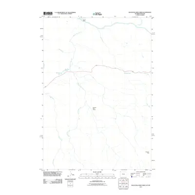
2011 Map of Blacktail Deer Creek
USGS Topo · Published 2011About this map
The Yellowstone River flows along the northern edge of this high-elevation landscape, where the confluence of several major drainages defines the local topography. This 2011 survey illustrates the hydrological network formed by Blacktail Deer Creek, Oxbow Creek, and Lupine Creek as they traverse the Blacktail Deer Plateau. The map highlights important navigational and natural landmarks, including Blacktail Bridge and the cascading waters of Wraith Falls in the west. To the east, the terrain rises toward the prominent elevation of Prospect Peak. Several distinct water bodies, such as Crevice Lake in the north and the tucked-away Phantom Lake near the central roadway, provide specific points of reference for researchers and outdoorsmen. The absence of dense residential development reflects the area's role as a managed natural environment, focusing instead on the intersection of water, terrain, and the few established access routes that cross this plateau.
Find a feature on this map
13 named features on this map. Tap any name to fly to it.
Don’t see what you’re looking for? This feature index may not catch every label — zoom into the map to look around manually.
Map Details
Editions of this 2011 Blacktail Deer Creek Map
This is the sole edition of this map. No revisions or reprints were ever made.
Other maps of this area

1885 · Gallatin
USGS Topo · 1:125,000

1885 · Gallatin
USGS Topo · 1:125,000

1886 · Canyon
USGS Topo · 1:125,000

1891 · Livingston
USGS Topo · 1:250,000

1893 · Livingston
USGS Topo · 1:250,000

1895 · Canyon
USGS Topo · 1:125,000

1896 · Canyon
USGS Topo · 1:125,000

1901 · Canyon
USGS Topo · 1:125,000

1901 · Gallatin
USGS Topo · 1:125,000

1907 · Canyon
USGS Topo · 1:125,000