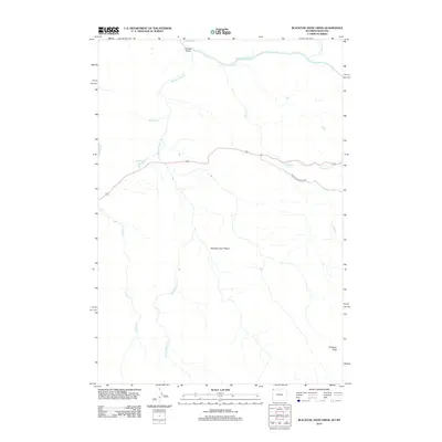
2012 Map of Blacktail Deer Creek
USGS Topo · Published 2012About this map
The Yellowstone River cuts across the northern reaches of this high-elevation landscape, where the Blacktail Bridge provides a crossing near Crevice Lake. South of the river, the expansive Blacktail Deer Plateau dominates the central terrain, drained by a network of waterways including Blacktail Deer Cr and Lupine Cr. This 2012 survey illustrates the modern road system cutting through the wilderness, specifically following the route of Blacktail Plateau Dr as it winds east toward Phantom Lake. Notable landmarks such as Wraith Falls and the overlook at Prospect Peak define the topographical character of the area. The map serves as a precise record of hydrologic features, from the small Blacktail Pond to the meandering courses of Rescue Cr and Oxbow Cr, capturing the undisturbed environment of the northern Rockies in the early 21st century.
Find a feature on this map
15 named features on this map. Tap any name to fly to it.
Don’t see what you’re looking for? This feature index may not catch every label — zoom into the map to look around manually.
Map Details
Editions of this 2012 Blacktail Deer Creek Map
This is the sole edition of this map. No revisions or reprints were ever made.
Other maps of this area

1885 · Gallatin
USGS Topo · 1:125,000

1885 · Gallatin
USGS Topo · 1:125,000

1886 · Canyon
USGS Topo · 1:125,000

1891 · Livingston
USGS Topo · 1:250,000

1893 · Livingston
USGS Topo · 1:250,000

1895 · Canyon
USGS Topo · 1:125,000

1896 · Canyon
USGS Topo · 1:125,000

1901 · Canyon
USGS Topo · 1:125,000

1901 · Gallatin
USGS Topo · 1:125,000

1907 · Canyon
USGS Topo · 1:125,000