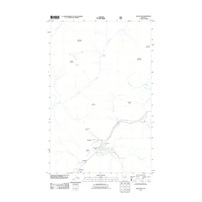
2011 Map of Blacktail
USGS Topo · Published 2011About this map
McCartysville Flats and the small settlements of Snowslip and Blacktail anchor this survey of the northern Rockies. The landscape is defined by high peaks like Brave Dog Mountain and Summit Mountain, with a network of drainages including Bear Creek and Ole Creek carving through the terrain. The infrastructure of the early 21st century is represented by the Fielding Patrol Cabin and Shaw Sheds, alongside recreation sites like the Fielding Picnic Area and Devil Creek Campground. The presence of Giefer Creek Rd and the corridor along the creek indicates the primary transit route through this mountain pass, connecting the isolated flats and mountain slopes. Notable high-altitude features like Ole Lake and Little Dog Mountain mark the more remote eastern sections of the quadrangle.
Find a feature on this map
24 named features on this map. Tap any name to fly to it.
Don’t see what you’re looking for? This feature index may not catch every label — zoom into the map to look around manually.
Map Details
Editions of this 2011 Blacktail Map
This is the sole edition of this map. No revisions or reprints were ever made.
Other maps of this area

1913 · Marias Pass
USGS Topo · 1:125,000

1914 · Nyack
USGS Topo · 1:125,000

1958 · Red Plume Mountain
USGS Topo · 1:24,000

1958 · Nimrod
USGS Topo · 1:24,000

1958 · Mount Bradley
USGS Topo · 1:24,000

1960 · Cut Bank
USGS Topo · 1:250,000

1963 · Cut Bank
USGS Topo · 1:250,000

1964 · Cut Bank
USGS Topo · 1:250,000

1964 · Essex
USGS Topo · 1:24,000
1964 · Mount Saint Nicholas
USGS Topo · 1:24,000