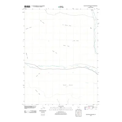
2010 Map of Blacktail Mountain
USGS Topo · Published 2010About this map
The Duchesne River winds through the heart of this landscape, its path defining the local geography as it flows toward its eventual confluence. To the south, Blacktail Mountain and the prominent Blacktail Ridge dominate the elevation, while Sand Wash carves through the lower slopes. The drainage patterns here are intricate, featuring numerous seasonal hollows such as Wagstaff Hollow and Seep Hollow that funnel toward the primary watercourses. To the northeast, the terrain levels out at Sadies Flat near the banks of Rock Creek. Access across this high-country terrain is provided by local routes like Rock Creek Rd and Rail Creek Rd, which parallel the water and follow the natural contours of the ridges. Distinctive landforms like The Nipple and McAfee Ridge serve as primary landmarks in this undeveloped corner of Duchesne County.
Find a feature on this map
15 named features on this map. Tap any name to fly to it.
Don’t see what you’re looking for? This feature index may not catch every label — zoom into the map to look around manually.
Map Details
Editions of this 2010 Blacktail Mountain Map
This is the sole edition of this map. No revisions or reprints were ever made.
Other maps of this area

1885 · Uinta
USGS Topo · 1:250,000

1939 · Duchesne
USGS Topo · 1:125,000

1954 · Salt Lake City
USGS Topo · 1:250,000

1958 · Salt Lake City
USGS Topo · 1:250,000

1960 · Salt Lake City
USGS Topo · 1:250,000

1962 · Strawberry Pinnacles
USGS Topo · 1:24,000

1962 · Blacktail Mtn
USGS Topo · 1:24,000

1962 · Tabiona
USGS Topo · 1:24,000

1962 · Rabbit Gulch
USGS Topo · 1:24,000

1962 · Dry Mountain
USGS Topo · 1:24,000