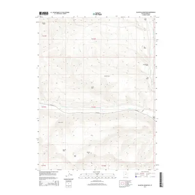
2014 Map of Blacktail Mountain
USGS Topo · Published 2014About this map
Uinta Valley serves as a focal point for this landscape, where the Duchesne River cuts through the high desert terrain. The topography is defined by a series of prominent ridges and drainages, most notably Blacktail Ridge and McAfee Ridge, which guide the flow of seasonal runoff through areas like Sand Wash and Brown Draw. This 2014 survey documents the modern layout of W Highway 35 as it follows the river valley, providing critical transit through the rural expanse of Duchesne County. To the north and south, the terrain rises sharply toward landmarks such as Blacktail Mtn and the distinctively named The Nipple. The convergence of Rock Creek with the larger river system illustrates the hydrologic patterns that have shaped land use and ranching boundaries in this part of the Uintah Basin.
Find a feature on this map
23 named features on this map. Tap any name to fly to it.
Don’t see what you’re looking for? This feature index may not catch every label — zoom into the map to look around manually.
Map Details
Editions of this 2014 Blacktail Mountain Map
This is the sole edition of this map. No revisions or reprints were ever made.
Other maps of this area

1885 · Uinta
USGS Topo · 1:250,000

1939 · Duchesne
USGS Topo · 1:125,000

1954 · Salt Lake City
USGS Topo · 1:250,000

1958 · Salt Lake City
USGS Topo · 1:250,000

1960 · Salt Lake City
USGS Topo · 1:250,000

1962 · Strawberry Pinnacles
USGS Topo · 1:24,000

1962 · Blacktail Mtn
USGS Topo · 1:24,000

1962 · Tabiona
USGS Topo · 1:24,000

1962 · Rabbit Gulch
USGS Topo · 1:24,000

1962 · Dry Mountain
USGS Topo · 1:24,000