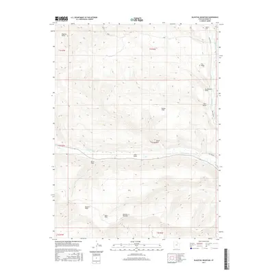
2017 Map of Blacktail Mountain
USGS Topo · Published 2017About this map
Uinta Valley serves as the central corridor of this Duchesne County landscape, where the Duchesne River flows eastward across the terrain. The geography is defined by a series of prominent ridges and draws, most notably the high ground of Blacktail Mountain and the adjacent Blacktail Ridge in the southern portion of the quadrangle. These elevations are cut by various drainages such as Brown Draw, Wright Draw, and Sand Wash, illustrating the complex erosion patterns of the region.
Find a feature on this map
22 named features on this map. Tap any name to fly to it.
Don’t see what you’re looking for? This feature index may not catch every label — zoom into the map to look around manually.
Map Details
Editions of this 2017 Blacktail Mountain Map
This is the sole edition of this map. No revisions or reprints were ever made.
Other maps of this area

1885 · Uinta
USGS Topo · 1:250,000

1939 · Duchesne
USGS Topo · 1:125,000

1954 · Salt Lake City
USGS Topo · 1:250,000

1958 · Salt Lake City
USGS Topo · 1:250,000

1960 · Salt Lake City
USGS Topo · 1:250,000

1962 · Strawberry Pinnacles
USGS Topo · 1:24,000

1962 · Blacktail Mtn
USGS Topo · 1:24,000

1962 · Tabiona
USGS Topo · 1:24,000

1962 · Rabbit Gulch
USGS Topo · 1:24,000

1962 · Dry Mountain
USGS Topo · 1:24,000