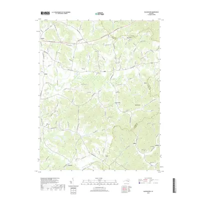
2019 Map of Blackwater
USGS Topo · Published 2019About this map
The Laurel River and its numerous tributaries, including Blackwater Cr and Robinson Cr, define the drainage of this portion of Laurel, Clay, and Knox Counties. This landscape is characterized by a dense network of family-named cemeteries and rural settlements, reflecting a long-standing pattern of dispersed mountain communities. The northern territory is traversed by major corridors like the Hal Rogers Pky and E Daniel Boone Pkwy, while the interior remains accessible via winding roads such as Manchester Rd. Notable landmarks like Cut Off Knob and Cave Rock rise above the valleys, marking the physical boundaries between communities. For genealogists, the map is a vital resource for locating ancestral resting places, including the Pilgrims Rest Cem, Camp Ground Cem, and Merrimac Cem, many of which are tucked away near small creek branches like Hooppole Cr and Muddylut Cr.
Find a feature on this map
126 named features on this map. Tap any name to fly to it.
Don’t see what you’re looking for? This feature index may not catch every label — zoom into the map to look around manually.
Map Details
Editions of this 2019 Blackwater Map
This is the sole edition of this map. No revisions or reprints were ever made.
Other maps of this area

1886 · Cumberland Gap
USGS Topo · 1:125,000

1888 · Cumberland Gap
USGS Topo · 1:125,000

1890 · Williamsburg
USGS Topo · 1:125,000

1891 · Manchester
USGS Topo · 1:125,000

1891 · Cumberland Gap
USGS Topo · 1:125,000

1893 · London
USGS Topo · 1:125,000

1894 · Williamsburg
USGS Topo · 1:125,000

1897 · London
USGS Topo · 1:125,000

1952 · Portersburg
USGS Topo · 1:24,000

1952 · Corbin
USGS Topo · 1:24,000