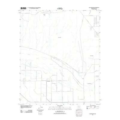
2011 Map of Blackwater
USGS Topo · Published 2011About this map
Blackwater serves as the central hub of this Pinal County landscape, where the seasonal flow of the Gila River and the Little Gila River dictates the pattern of local life and infrastructure. The map reveals a transition between the irrigated lowlands and the arid desert topography, punctuated by prominent rises such as Mineral Butte and Twin Buttes. A grid of named rural roads, including Baptist Church Rd and Blackwater School Rd, provides a framework for the residential clusters that define the settlement patterns in the early 21st century. The southern portion of the quadrangle is marked by the wide drainage of McClellan Wash, while the eastern reaches are overlooked by Walker Butte and Cholla Mountain. This survey effectively captures the relationship between the river valley's riparian corridors and the engineered water management systems like Canal Rd.
Find a feature on this map
48 named features on this map. Tap any name to fly to it.
Don’t see what you’re looking for? This feature index may not catch every label — zoom into the map to look around manually.
Map Details
Editions of this 2011 Blackwater Map
This is the sole edition of this map. No revisions or reprints were ever made.
Other maps of this area

1900 · Florence
USGS Topo · 1:125,000

1902 · Florence
USGS Topo · 1:125,000

1907 · Sacaton
USGS Topo · 1:62,500

1922 · Red Rock No 2
USGS Topo · 1:48,000

1922 · Signal Peak
USGS Topo · 1:62,500

1924 · Signal Peak
USGS Topo · 1:62,500

1934 · Newman Peak
USGS Topo · 1:125,000

1954 · Mesa
USGS Topo · 1:250,000

1956 · Sacaton NE
USGS Topo · 1:24,000

1956 · Magma
USGS Topo · 1:24,000