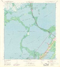
1947 Map of Blackwater Sound
USGS Topo · Published 1970About this map
Key Largo and the complex waterways of the upper Florida Keys are captured here in a 1947 survey updated through 1969. The map details the delicate boundary of Everglades National Park where it meets the sprawling waters of Blackwater Sound and Barnes Sound. Residential development is visible along the eastern corridor of Key Largo, particularly around Anglers Park and Largo Sound, while the surrounding keys like Boggy Key and Shell Key remain largely wild.
Find a feature on this map
47 named features on this map. Tap any name to fly to it.
Don’t see what you’re looking for? This feature index may not catch every label — zoom into the map to look around manually.
Map Details
Editions of this 1947 Blackwater Sound Map
3 editions found
Other maps of this area

1947 · Garden Cove
USGS Topo · 1:24,000

1947 · Rock Harbor
USGS Topo · 1:24,000

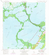
1947 · Blackwater Sound
USGS Topo · 1:24,000

1949 · Blackwater Sound
USGS Topo · 1:24,000

1949 · Rock Harbor
USGS Topo · 1:24,000

1949 · Garden Cove
USGS Topo · 1:24,000

1949 · Card Sound
USGS Topo · 1:24,000

1950 · Glades
USGS Topo · 1:24,000

1956 · Card Sound
USGS Topo · 1:24,000

1956 · Glades
USGS Topo · 1:24,000